Chlef
Chlef (الشلف, Berber: Clef) is the capital of Chlef Province, Algeria. Located in the north of Algeria, 200 km west of the capital, Algiers, it was founded in 1843, as Orléansville, on the ruins of Roman Castellum Tingitanum. In 1962, it was renamed al-Asnam, but after the devastating earthquake on October 10, 1980, it has borne its present name, Chlef, which is derived from the name of the Chelif River, the longest river in Algeria.
It is home to the soccer club ASO Chlef, the Hassiba Ben Bouali university, and the ruins of the basilica of Reparatus, who was bishop of Castellum Tingitanum from 465 to 475. A corner of the flooring of the basilica contained a mosaic labyrinth, the oldest known example of Christian use of this motif.
Chlef lies in a valley at an elevation of 114 m between two ranges of hills to the north and west. The city is surrounded by farmland; there are scattered trees both in the valley and on the hills.
Map - Chlef
Map
Country - Algeria
 |
|
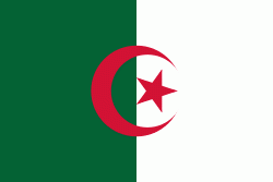
| Flag of Algeria | |
Algeria produced and is linked to many civilizations, empires and dynasties, including ancient Numidians, Phoenicians, Carthaginians, Romans, Vandals, Byzantines, Umayyads, Abbasids, Rustamids, Idrisids, Aghlabids, Fatimids, Zirids, Hammadids, Almoravids, Almohads, Zayyanids, Spaniards, Ottomans and the French colonial empire, with the latter expanded into its present-boundaries. After 132 years of being part of France, tensions between France and the local Algerian populace led to the start of the Algerian War which concluded with Algeria obtaining its independence on 5 July 1962 with the establishment of the People's Democratic Republic on 20 September of that year.
Currency / Language
| ISO | Currency | Symbol | Significant figures |
|---|---|---|---|
| DZD | Algerian dinar | دج | 2 |
| ISO | Language |
|---|---|
| AR | Arabic language |


